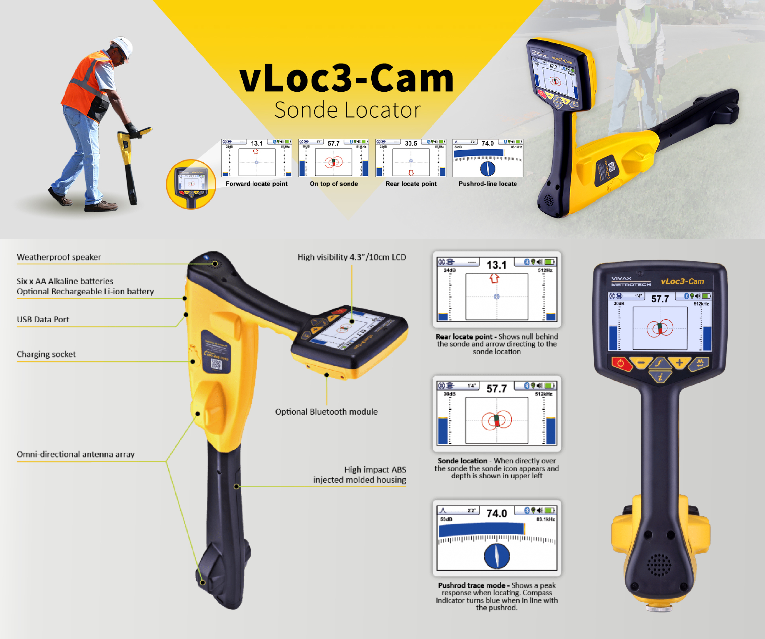
Vivax-Metrotech vLoc3-Cam Locator
The vLoc3-Cam is the easiest to use sonde and camera locator on the market today. The omni-directional antenna array allows for approaching the sonde from any position. Simple to decipher directional arrows direct the user through the bright colour LCD display to the accurate location and depth of the sonde or camera. The sonde is displayed as a picture on the display for ease of identification. This new technology with its two sets of 3D antennas provides consistently accurate results with the simplest interface available on the market.
The vLoc3-Cam includes multiple sonde frequencies making it compatible with the major push cameras and crawler cameras on the market. The Pushrod Trace mode shows a second display geared for tracing the path of the pushrod deployed in the pipe or tracing pipes with an optional portable transmitter.
The vLoc3-Cam comes with two Passive locate modes of Power and Radio which will detect the presence of live power lines, CATV, telephone and some metallic pipes which radiate 50/60 Hz from nearby or overhead power lines. For active locating, with the use of a portable transmitter, the vLoc3-Cam comes with an 83.1kHz frequency for tracing the pushrod. This frequency is also ideal for water and gas utilities which generally are larger pipes with bell housings and gaskets as well as locating ungrounded small diameter drop wires and inducing signals through the soil, onto services when direct connecting is not an option.
Key Features
- No ghost signals
- Graphical locate display
- Sonde locate and pushrod trace modes
- Optional Bluetooth option for GPS mapping
- High visibility colour 4.3”/10cm Display
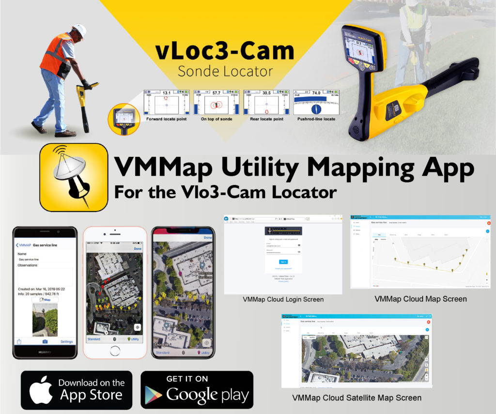
VMMap App
When used with Bluetooth enabled Vivax-Metrotech receivers, the VMMap Utility Mapping app records data from the field which is instantly available online via the VMMap Cloud web portal or can be shared by using the email function in the app. Location data is obtained from the mobile phone, or an external GPS device of your choice. Depth readings, GPS coordinates, the distance between locates and more are captured as data logs and can be saved as xls, txt, shp, and kml extension files. The data is compatible with Google Maps, Asset Management, and GIS software.
The image capture feature in the app allows the user to attach a JPEG format image to the surveys. This is useful to add points of interest or a snapshot of the completed survey. Access the image files and all the data captured in the app in the VMMap Cloud web portal or email it from within the app.
The VMMap app generates maps in real time, giving confidence to the field technician that the data being collected is accurate.
- Uses both Google and Apple Maps
- Low and high GPS accuracy settings
- Plug-and-play Bluetooth pairing to receivers
- Export to various file types for use with popular GIS programs
- Compatible with Google Maps, Asset Management, and GIS software
- Show multiple utilities on one map with color-coded utility drop pins
The VMMap Mobile application is compatible with both iOS and Android devices.
SHARE THIS PAGE